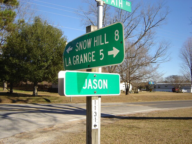
My name is Jason, so I’m just tickled that there is also a place named Jason. It was once a town, but the town dwindled over time, and now it’s just a country crossroads:
[Image description] A green road sign that reads “Jason.” Above it is another road sign with arrows pointing toward “Snow Hill 8” and “La Grange 5.” [end image description]
There is a derelict building which I believe was historically the general store of the town. Well of course I had to find out what has been observed in my namesake place.
Image description] iNaturalist Explore tab, map view, with bounding box centered on a map point named “Jason.” No location points are present. The observations box is a blank white panel with the words “No results found.” [end image description]
Nothing. The default bounding box, according to my measurements using the map scale, is 2 km on the short sides. In a town or a well-visited nature reserve, you would never see an area that size with zero observations. And this isn’t some inaccessible, remote region; you can see on the satellite view that it is all ag fields with good road coverage. Rural areas in general get a lot less iNaturalist activity; I suppose that most of the people who live there have other priorities in life, and most of us city folk go looking for nature either closer to home or in designated nature places. But the sheer area of agroecosystems and their importance in the larger landscape suggests that we are missing key parts of the picture by not filling them in.
That was my mission today. First, I manually expanded the above bounding box until it encompassed a scattering of 15 observations; then I wrote down what taxa they were so that I would be sure to look for different ones. Since I don’t know the full extent of the original, historic town of Jason, I decided just to poke around that derelict building at the named map point. I got a few observations.
Among the weedy growth taking over what had been pavement was this Erigeron, which I think is the same species commonly seen in town.
With some careful stalking, I was able to get a yellow grasshopper. There were many of these in the tall grass.
Wasn’t able to get a picture of the yellow-orange butterflies in the herbaceous thicket at the back of the derelict building; they moved around too much.
But I did get this young tree in the Walnut Family growing against the wall. It wasn’t in a place where someone would logically plant it, so I’m sure that it was wild.
I had hoped to add a third kingdom by finding lichens on the building; but no, the closest thing was some flaking paint that looked vaguely lichen-like.
With temperatures in the upper 90s, I didn’t feel it was wise to linger very long or walk too far from the car, but it’s a start – now, that search map of Jason will not be blank. And none of what I saw there were the same taxa as those 15 that I wrote down.
Agricultural zones might not hold the attraction of woodland trails or salt marshes, but they have their own important biodiversity and their own conservation needs. I encourage iNatters to help fill in these blanks when you can.

