Note: place creation is a large burden on iNaturalist, please see the warnings at https://www.inaturalist.org/places/new
Here is one way to get a boundary definition from OpenStreetMap to iNaturalist using QGIS and QuickOSM:
-
download and install QGIS
-
in QGIS, go to Plugins->Manage and Install Plugins
-
search for and install QuickMapServices (this will let you see OSM in QGIS)
-
search for and install QuickOSM (this will let you download OSM data)
-
turn on OSM with Web->QuickMapServices->OSM->OSM Standard
-
zoom to your area of interest, in this example I’m adding Gertrude Street Park
-
you will need a key/value that will return your shape – this can sometimes be a little tricky to figure out in QGIS, so one option is to view OSM on the web and use the Query features tool
-
after clicking on the park, I follow the link for Gertrude Street Park and make a note of the tags listed on the left
-
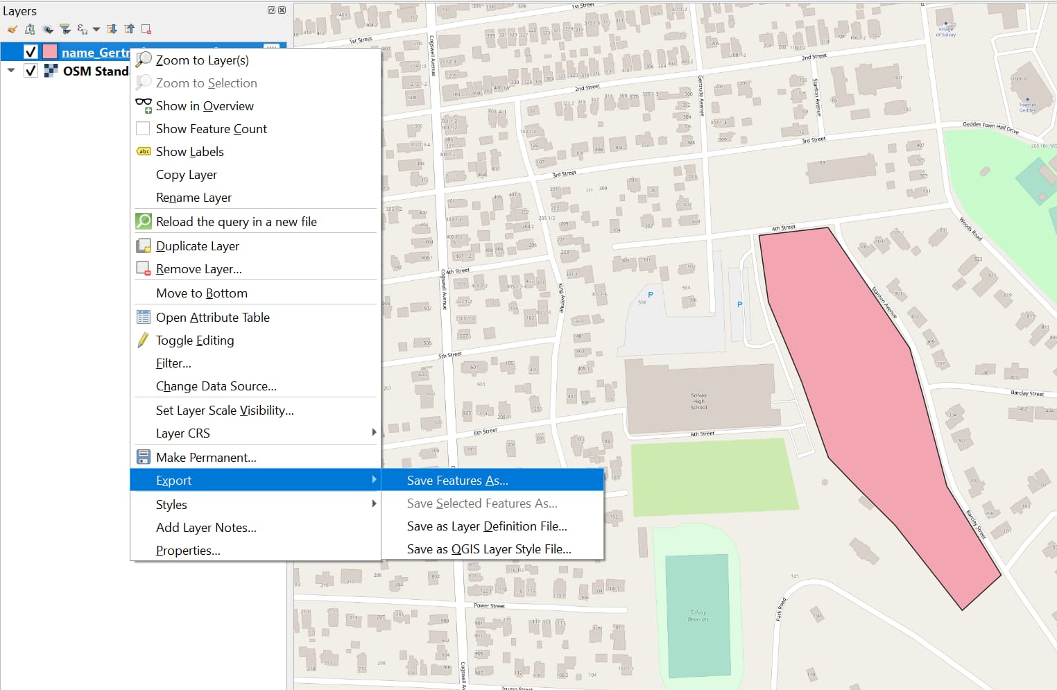
back in QGIS bring up the search with Vector->QuickOSM->QuickOSM
-
now I can use either leisure=park or name=Gertrude Street Park as my key/value, then specify Canvas Extent as the search area, and run the query
-
right-click the new layer in the layer manager, then Export->Save Features As, then save as KML
-
go to https://www.inaturalist.org/places/new and upload your KML file
-
be patient, the place may not be fully incorporated into iNat for a few hours