Yesterday I copied the ExifTool in the c:\windows directory and suddenly the Geosetter pops up in the context menu. I did not find an outdated map when I was using it.
Garmin Basecamp allows you to adjust time when you geotag your photos if your camera time is not accurate.
Smartphone users should turn on ‘location tag’ in camera settings. Works for me, and surprisingly when I’m off the grid.
Such metadata is sometimes lost with image manipulation, like resize and edit.
My DSLR does not geotag photos. I use an mobile app called GPS Status/GPS Logger, to acquire coordinates of locations of interest, and that is if I don’t get carried away with the fanfare of observing a unique/new species :-)
Thanks for the recommendation! Looks better than my current app GPS Status.
I’m very late to this topic and missed it before googling an alternate solution.
I shoot with a Nikon DSLR and found the geo tagging with their Snapbridge app to be woeful. Had hoped to link the camera with a GPS unit eg Garmin, via bluetooth, but that wasn’t an option. Nikon have a GPS unit but it is bulky and power hungry. In my search for an alternative I found a 3rd party unit that was cheaper and uses 1/3 of the power of the Nikon GP-1 unit.
So far the unit has worked really well with accurate GPS image tagging straight out of camera. No extra workflow steps needed.
Previously, I used the GPS logger application, but my phone periodically fell asleep and track recording was interrupted (although in the settings everything was optimized for the application to work). Plus, the battery drained much faster. In the end, I switched to Garmin Etrex 22, on AA batteries, it records tracks perfectly, I really like it.
What unit are you using? I killed my previous one and I’m looking for something cheap.
I got the di-GPS, model PF-2DC. Search dawntech to find manufacturer.
For those who do not wish to add apps or software, there is a workaround, it’s not the greatest but it does the trick.
- Take “the” good pictures with your DLSR and take a regular one with your cell phone (GPS enabled)
- When uploading on iNat, upload both, then “Select All” and “Combine”
- Delete/remove the bad picture
The Geotagging is still there. :)
https://www.gaiagps.com/ is what I use and find it to be a straight-forward as it gets. I like that I can name my tracks by where I visit and also keep my tracks “private” on the app. All of the data is uploaded to the website when save which is where I download my .gpx for geotagging. It’s free and available for android and does not require Facebook.
Yes, seems to have been some kind of glitch,. I’ve continued using it happily over the past month.
I see “Offline use” is not checked in the Free column. Are you still able to create GPX tracks without internet service with the app?
Yes you can! I still just use the free version which you can’t download the offline maps for but it will still record your location as you venture around. Under the “Trip” tab on the app, it will show you the number of satellites being used as well as the accuracy of your location.
For many cameras you can buy a GPS that mounts on the hotshoe
Just as an aside – I was out iNatting with @treegrow , and she TOTALLY convinced me to use a tracking app now. In the past, I’d just try to upload my observations as quickly as I could to try to remember their exact location… The tracking app is way better than my memory!
Hi Sam, thanks for this interesting tip. Are you just using it for a memory aid or is there more of a process you are using? Which app are you using?
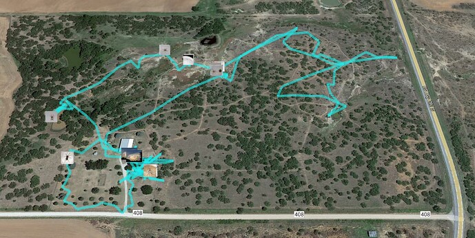
Yay tracking apps…I love them! I use GpicSync on my computer to tie my pics with the coordinate file and it creates thumbnails and a KML file that can be viewed in Google Earth. For some reason (I’m just weird), I like viewing my observations in Google Earth to “relive” my observation trek. It helps place any mis-located observations also b/c every once and a while the GPS coordinates are off by a good bit.
Do you have the Panasonic App on your smartphone (either Android or Apple) ? If you do, then you can synch the phone’s time and the camera’s time through the app and turn on the app’s Geotagging feature that will track your GPS location. So, when you take a photo on your FZ80, the phone will have the GPS recorded for the time. You have to keep the Panasonic app running. Then, you can transfer the location information to the images on the camera.
This is briefly described in the Advanced Manual on page 239 - 240. But, this video demonstrates it, as well. Don’t worry that it’s not the same exact camera in the video.
https://www.youtube.com/watch?v=Vc2JNT1-5SQ
This author, Graham Houghton, has a ton of videos on the FZ-80.
If you already use the app to transfer images from your camera to your phone, then this should be something that you can figure out. If you don’t know how to do that, here is another video to watch:
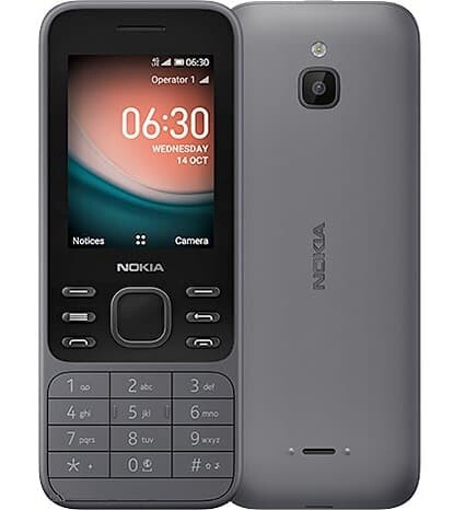
I really appreciate the suggestion, but it’s not something that will work for me, unless you can get the app on a Nokia 6300…

Hopefully your well-researched post will help someone else who does have a smartphone!
Thanks for the reply.
I tried to add a lot of information in case someone else was reading this. I have found a lot of helpful info in these forums.


