Accuracy is determined by where the pinpoint is placed on the map. The radius of the circle around it, although currently called Accuracy (Acc), should be called Precision. It reflects the level of confidence someone has about the accuracy of their placement if they were roaming an area, or if the specimen was mobile or far away; or can impart a level of uncertainty if someone’s worried about stalking/poaching etc.
It’s not just a semantics thing- the terms are scientifically distinct and ought to be used properly for best understanding. I’ve seen misunderstanding and confusion in some location-issue discussions. For example, someone had placed their pin accurately, but had their location marked inaccurate by another because the precision radius was not tiny. The viewer requested an increase in accuracy, but since the marker was already accurate the observer didn’t see why there was an objection.
Anyone marking an observation as “location inaccurate” when the actual location is inside the accuracy circle, to my mind, is mis-using that DQA. Even if it was outside that circle, it would not be until it was significantly outside that circle that I personally would mark it with the DQA. Regardless of what it is called, the DQA is (I believe) nothing to do with the size of the accuracy circle.
from the infobox in the DQA section of the observation view:
A related problem is that the obscuring rectangle on observations with large accuracy values can make a location look wrong, e.g. https://www.inaturalist.org/observations/37310204. That one got a down vote on accuracy because it really does look wrong until you closely examine the accuracy value. (See here for more.)
Well, I’m teaching this to my gen chem students shortly (it’s in chapter 1) and I can say that part of the understanding of precision is missing there. In a situation where you actually perform replicates, that standard description is true.
In a situation where you have taken a single measurement (an observation in this case), the precision is reflected by the fineness of measurement. In a lab setting, that depends on the gradations in or capability of your equipment. In the iNat situation it is dependent on the observer’s phone/GPS setting or personal recollection or their common sense- all of which would be reflected in the radius of the precision circle.
I tell my students that when they get into higher level chem they will get into the normal way of doing replicates and reporting precision with +/- error bars after doing error propagation etc. But at their beginner level, they won’t see replicates in a numerical problem and should judge precision by the significant figures (ie, fineness) they see in the values they are presented with.
Essentially, something is accurate when the circle is at the true location and precise when the circle is small. Either or both of those can be true – they’re independent. iNat doesn’t penalize people for having a large circle (imprecision), but observations should be DQA’d when the circle doesn’t encompass the true location.
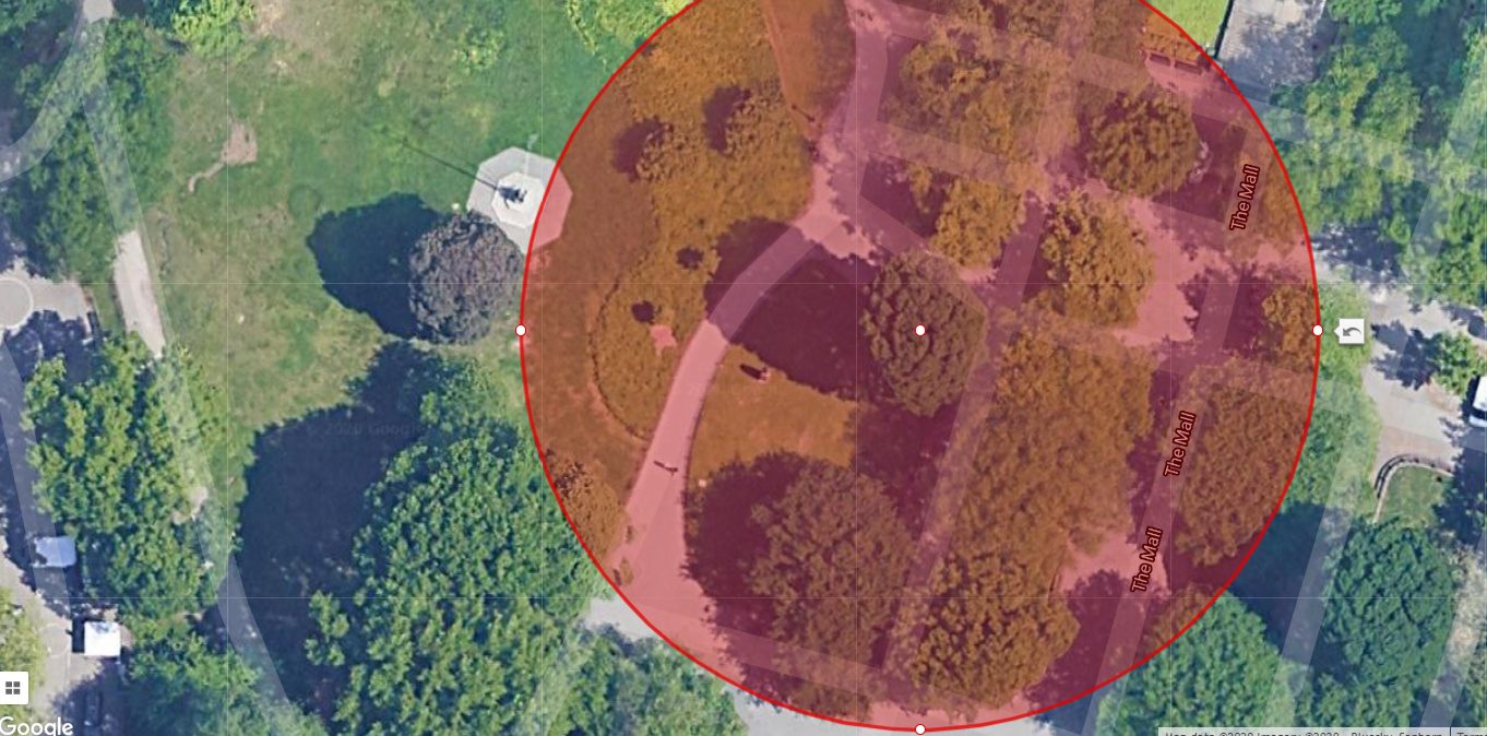
Yes, “exact” values do have infinite/irrelevant sig figs/precision. Like if I hold up 3 marbles, that’s exactly how many I have in my hand. Or If on the map I know I am describing the location of the exact tree I saw (good illustration above where you can actually visibly see the tree on the map), the precision circle for the tree is not really relevant, only the marker placement is.
But maybe the more typical case for iNat situations is, “I was in this park and so that’s why this pin is in the park, but we did a lot of walking that day, so I’ll just make the circle size a decent chunk of the park.”
i think “accuracy circle” or “circle of accuracy” is probably the better term, since that indicates that the true location is somewhere within the circle, which hopefully is always true, assuming good data. “precision circle”, to me, means that it is a representation / visualization of the precision of the center point of the circle relative the center point of your location, which could be what you’re trying to represent, but maybe it’s not. for example, in the first photo in jwidness’s example, you might be trying to say that that tree encompasses the entire circle, not that the center point of the tree is somewhere within x meters of the center point of that circle.
i think if you think of locations as points, then accuracy circle and precision circle are effectively interchangeable to me. but if you think of a location as something other than a point, then i don’t think precision circle is a proper all-encompassing term. (for example, what’s the location of London? it’s not just a point.)
So @lotteryd’s point is definitely correct (and kudos to @jwidness) for a really nice example in iNat conditions.
I think the main issue here is whether or not this change would improve usability or understandability for site users. A lot of folks don’t necessarily have the background to distinguish accuracy and precision in the technical sense (though of course they could with education).
Would changing “accuracy” to “precision” cause more confusion than it prevented? As someone familiar with these terms, I’ve been able to treat the “accuracy” iNat provides correctly in my analyses, and I expect other users of the data who are familiar with spatial data may be able to as well. I would expect that us folks on the message board are likely to have more knowledge of accuracy vs. precision than the general user, so while we might prefer the more “accurate” term (I personally would prefer precision), this might be an overall negative for the average user.
Sorry I don’t really have any contribution other than to raise that question!
i bet if you asked folks to make an observation of London in iNaturalist, most people would bascially draw a circle around something like the city boundaries. in that situation, they’re not saying anything about the precision of a particular point in London relative to the center point of the circle. they’re just saying that the it’s true (accurate) that London falls within that circle.
It depends on the device. Some devices don’t include the so-called accuracy in the metadata for an image, others do. (Can confirm the past 4 years of iPhone models do at least.)
I recall making this point on another thread (somewhere) about Accuracy vs. Precision and while my comment was acknowledged as correct and that iNat terminology might be incorrect, it was mostly unimportant from the standpoint of users who might not make a distinction. I agree with this view and don’t believe revising the site terminology would really change much…
It also depends on the organism. If I photograph a chickadee or a moth at X place, there is a good chance it will move around in a large Y space.
That could be a city block, a piece of bush &etc. I don’t photograph a lot of plants, but perhaps I should be more precise about their location.