In the MT Field Guides, what is the physical size, on the ground, of the blocks used on the Relative Density maps that show distribution of a species in the state? Do they correlate with Township and Range boundaries? Also, is there a good map to use that helps to locate the boundaries of those blocks with physical features or landmarks? Thank you.
Hi @jerrydimarco, welcome to the iNaturalist Forum. Are you referring to the maps on user-created guides? Like:
https://www.inaturalist.org/guides/7757?view=card

Or something else outside of iNaturalist, e.g. http://mtnhp.org/webinars/ ?
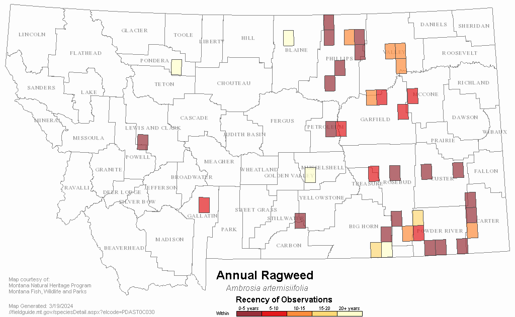
I believe you’re referencing this guide, with a map like this. They look like lat/long to me, and wouldn’t correlate with township. Not sure how you’d find boundaries. Maybe you could contact the site. The Contact Us link opens an email with some addresses to send to.
Yes, I’m referring to the Montana Field Guide and its Relative Density maps. I thought folks at MTNHP would see my post, but perhaps I need to contact them directly. Thanks.